Colorado Wilderness Project & Mount Zirkel Backpacking

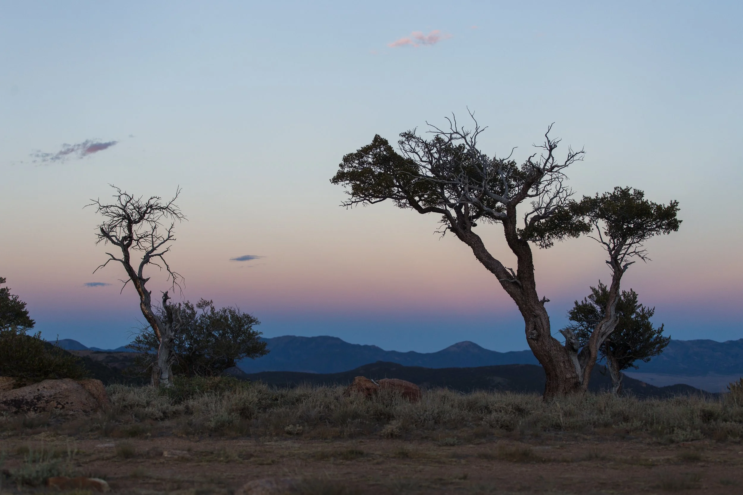
As a state covered with mountain ranges, national forests, and recreation areas, Colorado has 44 wilderness areas that highlight the state’s exceptional diversity of environments. From the BLM-managed red rock canyons of Black Ridge Canyons Wilderness to the windswept heights of Longs Peak in the NPS-managed Rocky Mountain Wilderness to the rare arctic tundra found in the USFS-managed Mt. Evans Wilderness, Colorado’s wilderness areas offer outstanding recreational opportunities. From the crowded Indian Peaks Wilderness less than an hour from Denver to remote and rarely visited West Elk Wilderness, chances for solitude can vary greatly, but all offer a chance to see the natural world in a way that “retain(s) its primeval character and influence.”

the trail to Bluebird Lake in Rocky Mountain National Park’s wilderness

wilderness areas are the dark green areas on this map

According to the text of the 1964 Wilderness Act, wilderness areas stand “in contrast with those areas where man and his own works dominate the landscape, is hereby recognized as an area where the earth and its community of life are untrammeled by man, where man himself is a visitor who does not remain."

starry skies over camp in Mount Zirkel Wilderness

As new Colorado resident as of July 2022, I have decided that an effort to visit each wilderness area in the state would be an excellent way to get acquainted with my new state. I kicked off the conception of this idea with a three day trip through the Mount Zirkel Wilderness, one of the original five wilderness areas in the country established in 1964.

cowboy camping on a bare mountain pass looking down a tree-covered valley

Cowboy camping at 11,000 ft. atop Ute Pass in the Mount Zirkel Wilderness

Below is a table with each wilderness area, the managing agency, year established, and the year I first visited (if any).

Wilderness Name

Agency

Year

Visited

Black Canyon of the Gunnison Wilderness

NPS

1976

August 2007

Black Ridge Canyons Wilderness

BLM

2000


Buffalo Peaks Wilderness

USFS

1993


Byers Peak Wilderness

USFS

1993


Cache La Poudre Wilderness

USFS

1980


Collegiate Peaks Wilderness

USFS

1980

July 2010

Comanche Peak Wilderness

USFS

1980


Dominguez Canyon Wilderness

BLM

2009


Eagles Nest Wilderness

USFS

1976


Flat Tops Wilderness

USFS

1975


Fossil Ridge Wilderness

USFS

1993


Great Sand Dunes Wilderness

NPS

1976

July 2008

Greenhorn Mountain Wilderness

USFS

1993


Gunnison Gorge Wilderness

BLM

1999


Hermosa Creek Wilderness

USFS

2014


Holy Cross Wilderness

USFS

1980


Hunter-Fryingpan Wilderness

USFS

1978


Indian Peaks Wilderness

USFS, NPS

1978


James Peak Wilderness

USFS

2002


La Garita Wilderness

USFS

1964


Lizard Head Wilderness

USFS

1980


Lost Creek Wilderness

USFS

1980


Maroon Bells-Snowmass Wilderness

USFS

1964


Mesa Verde Wilderness

NPS

1976


Mount Evans Wilderness

USFS

1980

July 2010

Mount Massive Wilderness

USFS, FWS

1980


Mount Sneffels Wilderness

USFS

1980

September 2020

Mount Zirkel Wilderness

USFS

1964

September 2022

Neota Wilderness

USFS

1980


Never Summer Wilderness

USFS

1980


Platte River Wilderness

USFS

1984


Powderhorn Wilderness

BLM

1993


Powderhorn Wilderness

USFS

1993


Ptarmigan Peak Wilderness

USFS

1993


Raggeds Wilderness

USFS

1980


Rawah Wilderness

USFS

1964


Rocky Mountain National Park Wilderness

NPS

2009

August 2010

Sangre de Cristo Wilderness

USFS, NPS

1993


Sarvis Creek Wilderness

USFS

1993


South San Juan Wilderness

USFS

1980


Spanish Peaks Wilderness

USFS

2000


Uncompahgre Wilderness

USFS, BLM

1980


Vasquez Peak Wilderness

USFS

1993


Weminuche Wilderness

USFS

1975


West Elk Wilderness

USFS

1964


a dead tree floating in Lake Katherine as sunset clouds reflect in the water

Mount Zirkel Wilderness

Over Labor Day weekend, I drove up the Cache La Poudre Canyon, over Cameron Pass, across North Park and arrived at the eastern edge of Mount Zirkel Wilderness at the Katherine Trailhead. My expectations of solitude were quickly dashed with my realization that it was opening weekend of archery season and dozens of camo-clad hunters were there to tromp thru the woods while carrying 50lbs of weight and not seeing a single animal.

A quick 2.5 mile hike up in the last hour of daylight got me to the shores of Lake Katherine. After hunting around for a campsite for a bit and finding plenty of other campers, I ended up camping at a dusty site right where the trail hit the lake. Since I arrived at sunset and intended to depart at dawn, I figured I’d be out before any dayhikers hit the lake. Dinner was an okay rendition of tikka masala made on the stove at home and then passed through the dehydrator. My main lesson was to dice chicken into smaller cubes as my rough shreds of chicken did not rehydrate well and had a texture most resembling tire rubber. The taste was there though!

morning reflections on Lake Katherine

The next day, I woke at sunrise with hopes of climbing the wilderness area’s namesake peak located about ten miles away across two mountain passes. As it turns out, I moved a bit slower than expected and took a nap in the shade next to Gold Creek at mile 5 so peakbagging aspirations would have to wait. I decided to hike another five miles and camp atop Ute Pass. This was a great decision and I had a few great hours overlooking the Bear Creek canyon and watching the shadows grow long over the trees and distant Rawah Range.

the trail up to Ute Pass

moonrise and the Belt of Venus over the distant Rawah Range

sunrise over my camp at Ute Pass

The next day was another sunrise wake-up courtesy of cowboy camping and nature’s own sunrise alarm clock. A quick four mile jaunt downhill got me on a the moto trail known as the Grizzly Helena trail. Every blind corner and hill the trail crossed I expected to be run down by a motocross rider, but the trail proved to be a quiet walk up and over a hill covered in aspens just a week or two before fall glory. After popping out on the gravel road at the North Lone Pine trailhead, I had less than a mile of road walking back to my car. Thus concluded my 17 mile circle in the Zirkels.

Snapshot from the Mojave- March 2022

After seven years of tromping about the Mojave Desert in all different seasons, this past March had a Mojave Desert first for me- the sighting of a desert tortoise. Sure, I stopped in at Red Rock Canyon State Park to see their captive tortoise on an annual basis and know his favorite foods are lettuce and strawberries, but seeing a real life tortoise on the 5% of their life spent above ground was a real treat.

a desert tortoise with a green mustache of plants they have been eating

This little guy/gal was on a rocky mining road about 200 feet above a sandy alluvial fan with creosote, cholla, barrel cacti and Joshua Trees. From the little I knew of desert tortoises, I did not expect a tortoise up on this rocky hillside since they couldn’t dig a burrow easily here. I guess with only a few days a year to eat, tortoises must roam quite a bit. After years of hiking and seeing no tortoises, I wasn’t keeping an eye out for them so this was an amazing way to end a weekend in the Mojave Preserve. We’d met up with friends from USC for the weekend, but everyone had left to go home by noon on Sunday so Kelsey and I shared this Mojave first together.

Snapshot from the Mojave- April 2021

a spiky sunset over the vastness of Mojave Preserve- established in 1994, Mojave National Preserve straddles somewhere between the rules and regulations of a National Park and the free-for-all of nearby Bureau of Land Management areas. On this day, we started driving by 8am and entered the western edge of the preserve and drove across the flat, rutted plain of Soda Dry Lake for five miles. From the lakebed, the rest of the day was spent climbing slowly through desert ecosystems that changed with elevation. We left behind the creosote and sparse vegetation of the low desert for joshua trees, cholla and finally piñon juniper woodlands in the canyons of the New York Mountains where we found camp.

Day 1 of a July 2020 Central Nevada roadtrip

Typically visiting Berlin, Manhattan, and Austin in a single weekend would be a downright daunting logistical nightmare spanning two continents and seven time zones. Luckily, if one can get themselves to Tonopah, Nevada, all these bustling cities can be visited with a single tank of gas and a 300 mile loop along some of the Silver State’s finest backroads. No, you won’t walk under the Brandenburg Gate on your way to the Reichstag Building, see the flashing lights of Times Square, or pass the Texas state capitol building; but you’ll see the glimmers of the past sparkling through the dust of Nevada’s old mining boomtowns. 

a well-built relic of the late 1860’s, this smokestack stands tall in central Nevada

Whether they hailed from these cities or thought their gold strike would spawn a similarly iconic city, Berlin, Manhattan, and Austin stand today as living ruins of the past and a testament to the resilient future. In July of 2020, a three day weekend and a lack of overnight backpacking permits in the Sierra sent Sammie and I across the state line to Nevada in search of solitude, hot springs, mountain peaks, and mining ruins of bygone eras. All were found in abundance. Sammie is a college friend from SC Outfitters, one of USC’s outdoor programs. She’d been living in Washington DC at the time and was back in California visiting family so getting out to some classic Western scenery was high on the to-do list.

a red toyota tacoma sits on a mountain ridge with a 4wd track leading further up the ridge behind

campsite views in the Toquima Range

After a quick pit stop to admire wild horses near Montgomery Pass on US 6, we made our way to Tonopah Dunes OHV area. Baking under the sun around 90º before 11am, the picnic tables and staging area were unsurprisingly empty. Under the shadow of the bankrupt Crescent Dunes Solar Tower, I aired the truck down to about 12 PSI and proceeded to roam around the low dunes. Very cognizant of the heat and lack of cell service, I didn’t push the Tacoma’s limits too much and stayed away from the steeper and larger dunes. 

the solar panels reflect to the tower and heat up salt to molten temperatures when it is then used to heat water to steam to spin turbines. Fancy tech and bankrupt in 2020 when we were there.

Rolling up and over waves of sand felt disorienting like we were adrift on an inland ocean of sorts. The tower of the solar plant would appear over the dunes at times reminding us of Nevada’s strange contrasts. After 30 minutes or so, we’d circled the dunes and explored what could prudently be driven in the circumstances and vehicle we had. I aired back up to highway pressure wondering what sort of OHVs had left their tracks on the highest dune faces over 300 feet above us. From here, it was a quick 15 minute ride to Tonopah, the last gas station for about two hundred miles. Filling up the tank didn’t take long and then we hit the road again. 

certain angles of the dunefield made you forget these were OHV dunes

It was a quick 50 miles into Manhattan and once there, we found the library. I’d heard there was a bit of a local history component to it and boy, was that right. An enthusiastic older man and woman spent the next half hour showing us photos and recounting the stories of Manhattan’s mining past under pressed tin ceilings and old mining machines scattered around the books. A gallery of photos of the museum is below. The last two images are of the church in town.

The lady’s father had brought them to Manhattan many decades ago and she was still here telling tales of the town’s past in her retirement. We were told what mines to look at on the way out of town and told to envision the giant hydraulic dredges tearing up the mountainside to create the current topography of streets threading their way through open pits. Having reached the ​​treeline of piñon and juniper, outside temperatures were quite pleasant. One of the librarian’s facts about Tonopah residents liking to buy summer homes in Manhattan finally clicked. 

Airing down the tires for the bumpy stagecoach road (and the next hundred miles on dirt)

A few miles out of town, we veered off the main county road to follow the original stagecoach road to Belmont, the next small town about ten miles away. What followed was an uniquely unpleasant ride on 6 inch high sandy washboards at a violently jostling 10mph. When the stagecoach road soon began to parallel the modern highway with the occasional car zipping by at 60mph, we really felt like the original travelers in their stagecoaches. At the first opportunity, we rejoined the pavement as well. 

The chimney from the original mill that processed Belmont’s silver ore. The town boomed from 1867-1888, but a number of residents have stuck in out and still call Belmont home.

Belmont was a quick stop as there were no community institutions other than the Dirty Dicks Saloon. Full to the brim with maskless SxS riders and the date being in June of 2020, we decided to press on into Monitor Valley where there were far fewer people. We stopped in the shade of a massive 1800’s mill for a lunch of hummus and bell peppers in pita pockets. Walking around this site was an impressive homage to the industry that had these hills alive with activity many decades ago. All that remains is the tall brick chimney and walls. The site was remarkably devoid of any graffiti and perched right at the edge of the trees. It was an amazing place to watch cloud shadows drift over the sagebrush sea and mountains of the Monitor Range. 

We utilized this tiny patch of shade for a lunch break.

150 years later and the brick walls are still standing

Here’s an 1872 photo of the mill at Belmont. Image is courtesy of Western Mining History. More photos and history here- westernmininghistory.com/towns/nevada/belmont/

A quick drive to the north led us to a canyon that rose to the crest of the Toquima Range. On the way up, we stopped at a gold mine that the librarians in Manhattan had told us about. I’m not sure if it was the right place or if it had been stripped by decades of like-minded treasure hunters, but a brushy scramble up a dry gulch led to collapsed shafts and a distinct lack of the gold bearing, quartz veined rock we were told would abound.

The Flower Mine camp from the washed out road that used to lead to the mine.

Nearly to the crest, we made a detour to a Forest Service Guard Station with a spring bubbling out of a pipe. Located in a high mountain meadow, this cabin was in an idyllic spot with grasses bobbing in the breeze. Guard stations are a forest service tradition from the 1920’s when remote parts of the national forest often took many days to reach and rangers or trail crews would be based out of the cabin while conducting patrols or work in the area. In the coming decades, automobiles rendered many of these cabins obsolete and hundreds were torn down. A lucky few remain like this one.

Meadow Canyon Guard Station is a cabin that forest service employees used to use a hundred years ago.

Meadow Canyon Guard Station and its outhouse

The old corral still stands in the meadow next to the cabin. The two photos below are of the inside of the guard station.

a spring in the meadow next to the cabin

Yours truly rinsing up at the spring.

A final climb in 4Lo separated us from the crest and camp. We set up in some small trees below Mt. Jefferson. With a few hours till sunset and Comet Neowise, we set up lawn chairs, donned a light jacket and settled into some good books.

Surveying the landscape before calling it a night with camp here.

I was reading Eating Stone by Ellen Meloy. I learned much about the ways of bighorn sheep in the southwest and the quiet appreciation of the wild that comes with decades of observation. 

sunset from our ridgetop campsite

The Belt of Venus appears on the eastern horizon after sunset.

As the sun set, the lights of Round Mountain mine came on many thousands of feet below us. They could not take away from the celestial spectacle that soon appeared though. Comet Neowise was making its once every 6,800 year visit past Earth and was spectacular in the dark skies of central Nevada. The ion trail adjacent to the main comet trail was clearly visible. With the Milky Way arching overhead, we enjoyed the 45 minutes of comet viewing before Neowise set behind the western horizon. The faint glow of Las Vegas could be detected by my camera despite being 200 miles distant from us.

the stars start coming out in blue hour

Comet Neowise arcs across the sky over Nevada's Alta Toquima Wilderness

Comet Neowise gradually became more and more visible as the sun’s light faded out of the sky.

a closely cropped photo of Neowise. Look closely and you can faintly see the blue ion trail of the comet taking off at one o’clock

The Milky Way and Jupiter over Nevada’s Toquima Mountains. The glow of Las Vegas is visible behind the tree in the center.